Gisela Simmons · 16 October 2026
Tracing the Development of Community-Driven Weather Monitoring Networks for Backcountry Snow Travel Safety
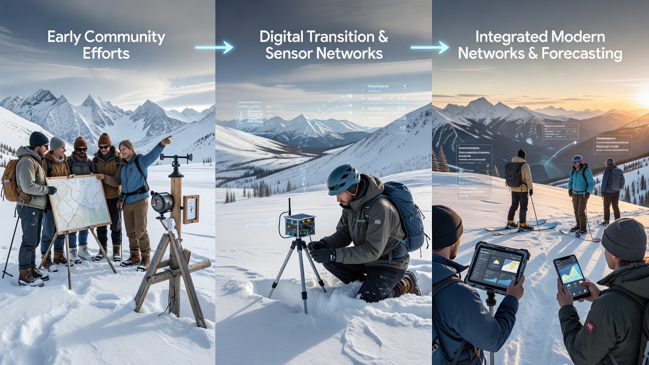
Community-driven weather monitoring networks for backcountry snow travel safety began forming in the mid-20th century when recreational skiers and mountaineers started sharing manual observations of snow conditions and weather patterns through local clubs and printed bulletins. These early efforts relied on handwritten logs from remote cabins and trailheads where volunteers recorded temperature, wind speed, and snowfall amounts before transmitting data via radio or mail to central coordinators. Researchers discovered that such grassroots systems filled gaps left by official stations which often sat at lower elevations or urban sites and missed critical high-alpine variations.
Early Foundations in the 1970s and 1980s
By the 1970s organized groups in North America and Europe began formalizing these exchanges into regional databases, and the process accelerated when portable altimeters and basic anemometers became widely available to the public. Observers note that networks expanded rapidly after major avalanche incidents highlighted the need for localized forecasts, leading to partnerships between ski patrols and academic departments that supplied standardized reporting forms. Data from these periods shows participation grew from dozens of contributors to hundreds as word spread through outdoor magazines and club newsletters.
Digital Transition and Sensor Integration
The shift to digital tools in the 1990s introduced dial-up bulletin boards and early websites where users uploaded observations in real time, and this change allowed networks to cover wider geographic areas with greater speed. Experts have observed that community members in the Rocky Mountains and the Alps pioneered the use of automated snow pillows and temperature probes connected to simple telemetry units, creating datasets that researchers later cross-referenced with satellite imagery for improved model accuracy. One study revealed that these hybrid human-machine systems reduced response times for weather alerts from days to hours during storm events.
Expansion Through Citizen Science Programs
Into the 2000s mobile phones and GPS devices enabled broader participation, and programs such as community snow observation initiatives encouraged backcountry travelers to submit structured reports via apps that aggregated information across entire mountain ranges. Figures reveal steady increases in data volume each winter season, wth contributions from Canada, Scandinavia, and New Zealand complementing North American sources to form more complete pictures of storm tracks and wind loading patterns. What's interesting is how these networks incorporated feedback loops where users received customized forecasts based on the very data they supplied, reinforcing continued engagement.
Academic institutions played supporting roles by developing open-source software that standardized data formats, and government agencies in multiple countries began incorporating community feeds into official warning systems after validation studies confirmed reliability. According to records from Environment and Climate Change Canada, integrated community inputs helped refine avalanche danger ratings in remote zones where traditional instrumentation remained sparse.
Recent Milestones Leading Into 2026
By October 2026 several longstanding networks had merged platforms to share sensor calibration standards and cloud storage resources, resulting in unified dashboards accessible across devices. Those who've studied this evolution note that low-cost IoT weather stations deployed by volunteers now transmit wind, humidity, and snow depth readings at intervals measured in minutes rather than hours, and the resulting datasets support machine-learning models that predict micro-scale hazards with increasing precision. Research indicates participation rates climbed further after successful pilot projects in Australia’s Snowy Mountains and the Pyrenees demonstrated cross-continental applicability.
Industry organizations supplied training modules on equipment maintenance and data quality control, while universities hosted annual workshops that connected contributors from different regions. The reality is that these collaborative structures continue to evolve through shared protocols rather than centralized control, allowing rapid adaptation when new sensor technologies emerge.
Conclusion
Community-driven weather monitoring networks have progressed from handwritten notes passed among small groups to sophisticated, interconnected systems that combine volunteer observations with automated sensors and digital platforms. Evidence suggests this trajectory will persist as technology lowers barriers to entry and international data-sharing agreements strengthen, providing backcountry travelers with increasingly detailed information for safe decision-making in variable snow environments.